3D Subsurface Utility Engineering


Minimizing Risk – Saving Time & Money.
With over 100 billion feet of underground utilities nationwide, an underground utility is damaged every six minutes, costing millions of dollars.
We understand the aging conditions of the existing infrastructure in communities across the State of Florida. Installed 50-60 years ago, and these facilities are not always clearly identified or even marked on utility record drawings or as-builts.
Knowing the exact location and condition of underground utilities are a top priority. Subsurface Utility Engineering (SUE) eliminates unexpected utility conflicts, unnecessary relocations, and disastrous and costly damage.
We are industry leaders providing utility designation and location services for the past 20 years. We combine state-of-the-art technology with experienced professionals and accurately locate underground utilities, helping engineers, designers, contractors, utilities, and government entities manage risk.
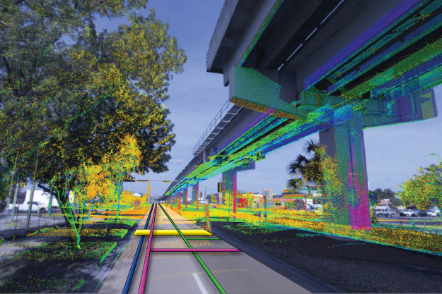
We integrate innovation and technology using a high-speed Ground Penetrating Radar (GPR) array, to collect 3D GPR data at posted roadway speeds. Our advanced technologies allow us to provide our clients with 3D underground models and GIS compatible deliverables.
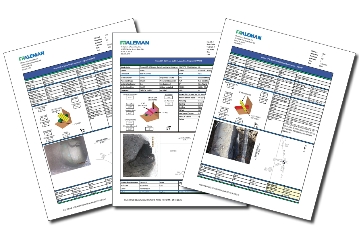
We have located 300,000+ test holes, has designated 5,000,000+ linear feet of underground utilities, and completed 2,500+ SUE and utility related work orders across the State of Florida.
Benefits
– Eliminate utility damage
– Reduce construction cost
– Expedite project schedules
– Identify conflicts early with time to adjust design
– Increase safety for the community & contractors
3D SUE Services
– 3D Utility Modeling
– GIS Utility Data Management
– Ground Penetrating Radar (GPR)
– Potholing
– Subsurface Utility Engineering (SUE)
– Test Holes/Vacuum Excavation
– Utility Designation
– Utility Location